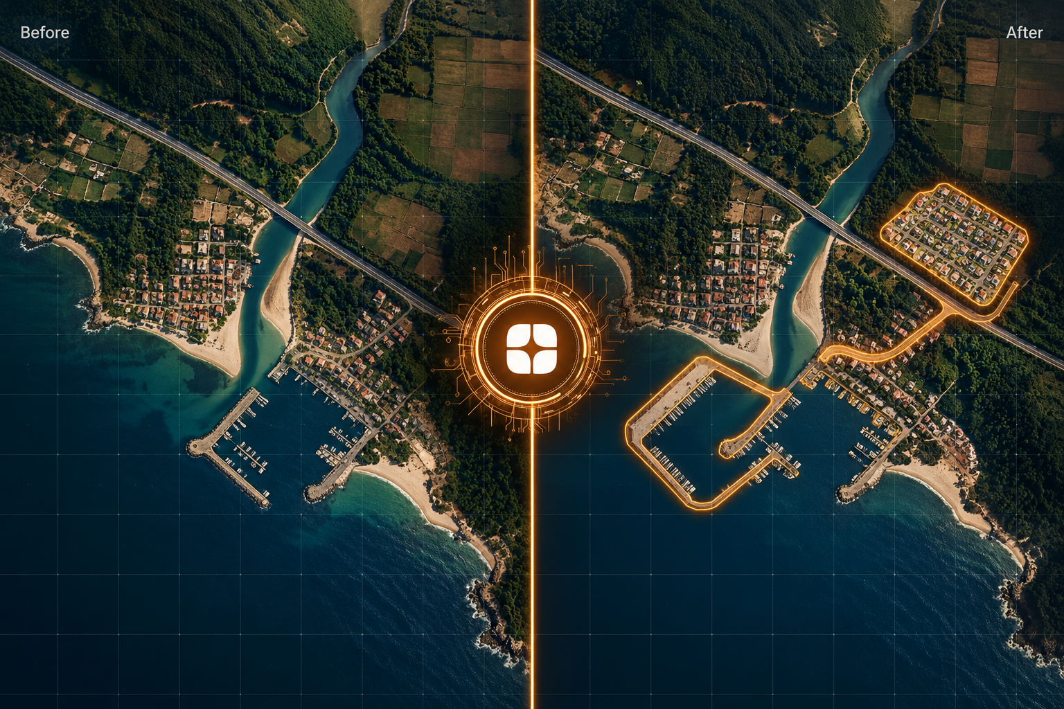
Most geospatial models answer a simple question: what is on the ground here? Change detection asks a harder one: what is different from before? It powers work like tracking urban growth, monitoring infrastructure, watching shorelines, and keeping land records current. The model has to compare two moments in time and decide which differences are real.
That shifts everything about how the data must be labeled. In change detection annotation, the label does not describe a single image. It describes the relationship between two images. A mistake in either image, or in how the two are paired, corrupts the result. This is a large part of what separates geospatial AI training data built by specialists from data built by general labelers.
The basic input is an image pair: an earlier image and a later one of the same location. Some projects use longer sequences with several dates. The annotator compares them and marks what changed, usually as polygons or masks over the affected area, along with a label for the kind of change.
Typical examples include a new building where there was an empty plot, a cleared patch where there was woodland, a shoreline that has moved, or a new road cutting across open land. The model then learns to flag similar differences in new image pairs automatically.
Output formats vary. Some projects want a binary mask that simply separates changed from unchanged areas, while others want a class for every transition. Either way, the guidelines must say exactly what the annotator is expected to deliver.
Because the label depends on comparison, an annotator cannot rely on a single glance. They have to hold both images in mind, know what each should show, and judge whether a visible difference is a genuine change on the ground or an artifact of how the images were captured.
Several problems appear again and again in this work, and each one can quietly damage a dataset.
Image co-registration means the two images line up so that the same ground location sits at the same pixel in both. When they are even slightly off, the edges of buildings, roads, and fields appear to shift, and a model reads that shift as change. Trained annotators learn to spot misaligned pairs and flag them instead of labeling phantom differences.
Differences in sun angle change how long shadows are. Different sensors, viewing angles, and atmospheric conditions alter how surfaces appear. A tall building can seem to lean differently when photographed from another angle. Seasonal appearance can also mimic change. A specialist separates these effects from changes in the surface itself.
Useful datasets define transitions: vegetation to built-up, water to bare ground, open land to road. A project must decide which transitions matter and what counts as too minor to label. A vehicle that has moved is not a change worth mapping, while a new foundation might be.
A pair separated by two weeks answers a different question than a pair separated by ten years. Annotators need reliable acquisition dates, a clear before and after order, and rules about which pairs are valid for a given project. Without that metadata, even careful labels cannot be interpreted correctly later.
In a typical pair, the vast majority of the area is identical, and the real changes are small by comparison. Missed small changes and falsely flagged ones both distort a model trained on mostly unchanged pixels, so labeling discipline matters more here than in many other tasks.
Remote sensing specialists and GIS-trained annotators approach an image pair the way an analyst would. They check whether the pair is usable before labeling it, read composites that make surface differences easier to see, and apply transition definitions consistently across thousands of tiles.
They are also the people who can write rules for the ambiguous cases: construction that is half finished, seasonal wetlands, temporary structures, and surfaces that look different but have not actually changed. Those rules are what keep a large team consistent, and they are easy to write only when the author understands how the imagery was formed. They also make quality review practical, since a reviewer can check a label against a written standard instead of a personal opinion.
This reflects Globik AI’s approach of using verified domain experts for work where judgment matters. For teams building this kind of dataset, it helps to start with how single images are labeled. Our guide on why satellite imagery annotation needs remote sensing specialists covers the foundations of land use and land cover labeling.
If you are preparing a change detection dataset, these steps catch most problems early:
Change detection is only as trustworthy as the comparison behind each label. When pairs are misaligned, transitions are vague, or shadows are mistaken for construction, the model learns to see change that never happened. Strong change detection annotation treats the pair, not the single image, as the unit of work, and it relies on people who know what real change looks like from above. For teams preparing training data, that usually means deciding on definitions and review standards before labeling starts, not after the first model disappoints.
It is the labeling of differences between two or more images of the same location taken at different times, so a model can learn to identify what has changed.
It is the alignment of two images so that every ground location matches the same pixel position in both.
They alter how surfaces and structures appear between dates, so an annotator might mistake a lighting difference for a real change on the ground.
They are labeled from-to transitions, such as vegetation to built-up or water to bare ground, that describe what a location changed from and into.
The time between two images determines which changes can be detected and what question the dataset can answer.