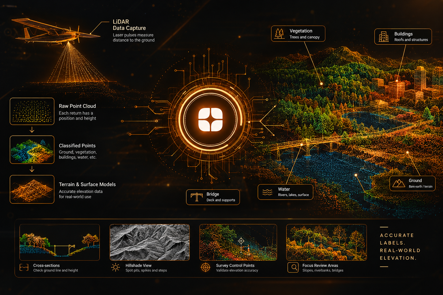
A LiDAR sensor mounted on an aircraft or drone fires laser pulses at the ground and records how long each one takes to return. Every return becomes a point with a position and a height, and millions of them together form a point cloud. The cloud is impressive to look at, but on its own it does not say which points are the ground, which are treetops, and which are rooftops.
That decision is the heart of LiDAR terrain labeling. The points labeled as ground become the base for a terrain model, and the rest describe what stands on top of it. When the labels are right, a 3D map matches the real landscape. When they are wrong, the error spreads quietly through everything built on that surface. This is why geospatial AI training data for elevation work needs more than speed.
The core task is point classification. Annotators or assisted tools assign each point to a class such as ground, low vegetation, high vegetation, building, water, bridge deck, or noise. The exact list depends on the project.
The labels serve two products. A digital terrain model shows the bare earth with everything removed. A digital surface model includes trees and buildings as well. Comparing the two gives the height of objects above the ground, which is why accurate ground labels matter so much.
Projects may also add breaklines, which are lines drawn along features such as ridges, riverbanks, and road edges. They keep the surface from rounding off sharp changes in the landscape.
The easy cases are open fields. The difficult ones are where the ground is hard to see.
Under thick canopy, only a few laser pulses reach the soil. A point near the bottom of the canopy might be ground, or it might be a low shrub. Labelers have to judge using the surrounding points, not guesswork.
On a hillside, a low wall, a terrace, or a cut bank can look like a small obstacle or part of the slope itself. The right answer depends on the project's definition of ground.
Calm water can return few points or odd readings, and riverbanks need careful treatment so that the water surface and the land are not mixed together.
The deck is not ground, yet the road approaching it is. The ground beneath the structure still has to be represented properly, so the surface does not rise to meet the bridge.
Birds, haze, and reflective surfaces can produce stray points above or below the real surface. Left in place, a few low outliers can pull a terrain model downward.
Overlapping flight lines, scan edges, and gaps change how many points cover each area. Annotators need to know where the data is dense enough to trust and where it is thin.
A terrain model is built by estimating the surface between ground points. If a handful of those points are wrong, the surface between them shifts too, and the mistake covers an area far larger than the points themselves.
The effect reaches every use of the model. Slope, drainage direction, and volume calculations all depend on the surface being correct. A 3D model built on a distorted base will look convincing and still give wrong answers. This is the reason elevation data labeling is judged by how the surface behaves, not by how clean the classification looks from above.
Reviewing LiDAR labels in a top-down view alone is not enough, because height errors can hide from above. Good review uses several views:
These checks catch problems that a pass over the point colors would miss.
Remote sensing specialists understand how laser pulses interact with leaves, branches, and soil, and why multiple returns from one pulse tell a story about what was beneath. They know the difference between a terrain model and a surface model, and they know how to write class definitions that hold up on varied ground.
They also know when to question the data. A strange dip in the surface might be a real sinkhole or a cluster of noise points, and telling them apart takes experience. This reflects Globik AI's approach of using verified domain experts for work that depends on judgment.
Drones can carry LiDAR as well as cameras, so the two kinds of data are sometimes collected together. For the imagery side of that work, see our guide on drone imagery annotation for site inspection and environmental mapping.
Before starting a LiDAR labeling project, settle these points:
LiDAR gives teams a direct measurement of the landscape, but it only becomes a trustworthy elevation surface once the points are classified correctly. Dense vegetation, steep slopes, water, and bridges all make that classification harder. Careful LiDAR terrain labeling, reviewed in cross-section and guided by clear definitions, produces 3D geospatial models that match the ground they describe.
It is the process of classifying LiDAR points as ground, vegetation, buildings, water, and other classes so a terrain model can be built accurately.
A terrain model shows the bare ground, while a surface model also includes trees, buildings, and other objects.
Few laser pulses reach the ground under thick canopy, so ground points are sparse and harder to identify.
The terrain surface is estimated between ground points, so a few wrong points can shift the surface across a much larger area.
They understand how laser returns behave and can apply consistent rules to ambiguous slopes, water, and canopy.